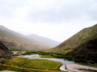
Water sharing between Central Asian countries has been conflicting for quite a long time already.
The Status of Glaciers in the Hindu Kush-Himalayan Region
This report provides a comprehensive account of the glacier coverage of the entire Hindu Kush-Himalayan region based on a standardized analysis of satellite images over a limited time frame. A mountain web portal (http://geoportal.icimod.org/HKHGlacier) has been set up to complement the report and provide easy access to the data and analyses. The report and the database serve as a significant step in filling the gap in information on the glaciers of the Hindu Kush-Himalayan region. The data analyses are presented in terms of the major river basins: Amu Darya, Brahmaputra, Ganges, Indus, Irrawaddy, Mekong, Salween, Tarim, Yangtze, and Yellow, and the large Himalayan interior basin. These basins extend across the seven Hindu Kush-Himalayan countries of Afghanistan, Bhutan, China, India, Myanmar, Nepal, and Pakistan. The eighth Hindu Kush-Himalayan country, Bangladesh, has no glacial cover. A consistent remote sensing methodology was used to delineate the clean-ice and debris cover of glaciers and the glacier attribute parameters which are documented in line with the standards provided by the World Glacier Monitoring Services. The report provides a comprehensive account of glaciers to cover the entire region utilizing a uniform methodological approach


